UNITED STATES GEOGRAPHY


"Hodgepodge About Kentucky" (March 1999) presents basic demographics and physical geography about the Bluegrass State in a fun way from popular sources.

Hodgepodge About Kentucky.pdf Hodgepodge About Kentucky.pdf
Size : 84.919 Kb
Type : pdf


Old Mulkey Meeting House, erected in 1804, is the oldest freestanding meeting house in Kentucky.  Located just south of Tompkinsville in Monroe County, the site features a pioneer cemetery with graves of early Kentucky settlers, Revolutionary War soldiers, and notables like Hannah Boone, sister of Daniel Boone.


Presented at the 23rd Annual Warren L. Susman Graduage Student Conference in April 2001 at Rutgers University, "Geography As A Historical Determinant: A Brief Study of Fort Loudoun, Monroe County, Tennessee" highlights site and situation as determining factors for the location, construction, occupation, and abandonment of the fort.  Revised March 2011.


Fort Loudoun on Tellico Lake in Monroe County near Vonore highlights the colonial period of American history that predates Tennessee statehood  (1796) and the Revolutionary War era (1775-1783).  The original fort was occupied by British soldiers from 1756 to 1760 to ally the Overhill Cherokee and serve as a buffer to the French in the region.  The reconstructed fort has blacksmith and gunsmith shops, storeroom for quartermaster supplies, powderhouse, an 18th-century infirmary, soldiers' barracks, and officers' quarters.


The U.S. census data for foreign immigrants to Coffee County, Tennessee from about 1850 to 1920, the Era of Immigration, was summarized initially in Fall 1999, presented at the Annual Tennessee Conference of Historians in Fall 2001 at Middle Tennessee State University in Murfreesboro.


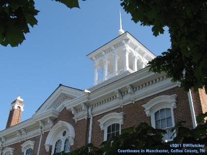
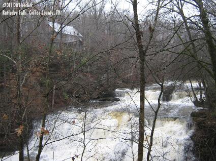
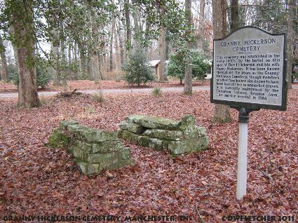
Coffee County, formed in 1836 from Bedford, Franklin, and Warren counties and name for Tennessee state militia General John Coffee, has a total area of about 435 square miles.  From 1850 to 1920, the county's population more than doubled from about 8,000 to over 17,000.  Sites like Granny Hickerson Cemetery and Rutledge Falls about five miles southwest of Manchester preserve the landscape of this earlier time.


The U.S. census data for foreign immigrants to Knox County, Tennessee from about 1850 to 1880 was presented at the Annual Tennessee Conference of Historians in Fall 2002 at East Tennessee State University in Johnson City.


Knox County, created in 1792 from Greene and Hawkins counties and named for U.S. Secretary of War Henry Knox, has a total area of about 526 square miles.  From 1850 to 1880, the county's population more than doubled from about 18,000 to over 39,000.  Marble Springs was the home of John Sevier, Tennessee's first governor, from about 1801 to 1815.  The State Historic Site portrays typical structures during this earlier period of settlement.